

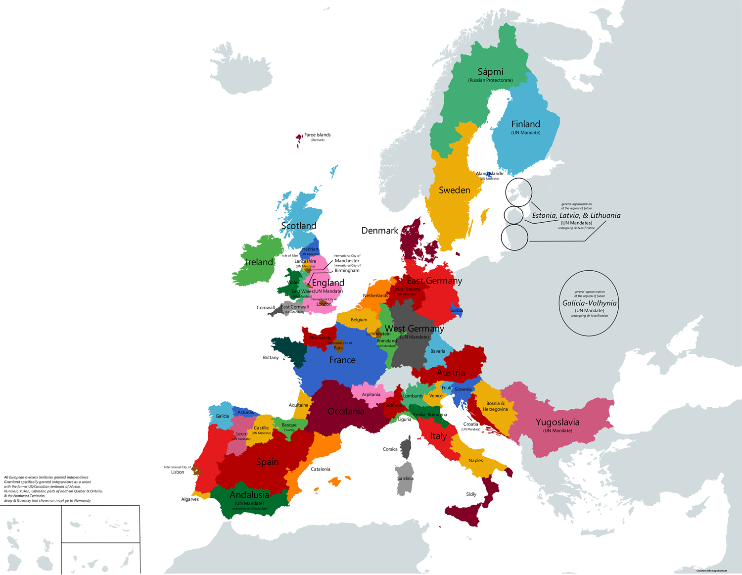
I saw @ledlecreeper27@lemmygrad.ml 's post and wound up making a larger version of it (with my own changes)
Update- wound up making a expanded version

and a notion of how it would look amidst a better world (not overly serious, borders subject to change)
Switzerland’s borders were unchanged, so I didn’t bother coloring it in or labeling it tbh (also, Galicia-Volhynia is only referring to the specific westernmost regions of Ukraine)
Most of eastern Europe (and western too) is in urgent need of denazification though. Overall map needs more labels.
Fair- I agree tbh. I’d say I was simply being lazy in that regard (mapchart, the site I was using, with the NUTS2 map didn’t go into detail about Ukraine, Russia, Belarus, and Norway among other countries, so rather than go through the hassle of, say, overlaying the map with borders in a different program and from there tracing out different regions I’d want to cut out- I just left them empty, minus the denazification/vague territorial change circles in Estonia, Latvia, Lithuania (all of which I’d have made far smaller) and western Ukraine.